

In late July 2024 I did a three day, two night trip through the Buckhorn Wilderness of Olympic National Forest—a festival of jagged peaks, wildflowers, and pleasant singletrack at the edge of Olympic National Park. I covered 25.5 miles, with about 7,800 feet of elevation gain.
Day 1
9.3 miles | 3,958’ elevation gain
I started at the Tubal Cain Trailhead. It’s a very long but pretty drive in from Route 101 near Sequim, Washington. No parking pass is needed for this trailhead, and the sites on this trip did not require permits.
The first five miles to Buckhorn Lake is a pleasant and steady climb, mostly through shaded forest featuring rhododendron alleys and mossy, older growth trees. At Copper Creek there’s an option to take a long switchback or a more direct but steeper trail. I took this shortcut going out and coming back, and it offered some of the first of many stunning views.
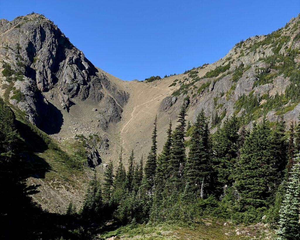
After the trail junction near Buckhorn Lake the climbing really begins in earnest. Lots of switchbacks and many more incredible views. The last few switchbacks are short and steep, but you’re then rewarded with an easy walk over to Marmot Pass.
At Marmot Pass I dropped down to Camp Mystery to fill up on water for the night. It’s less than a mile down to Mystery, but you lose about 450’ in elevation that you have to gain back if you’re planning to camp at the pass.
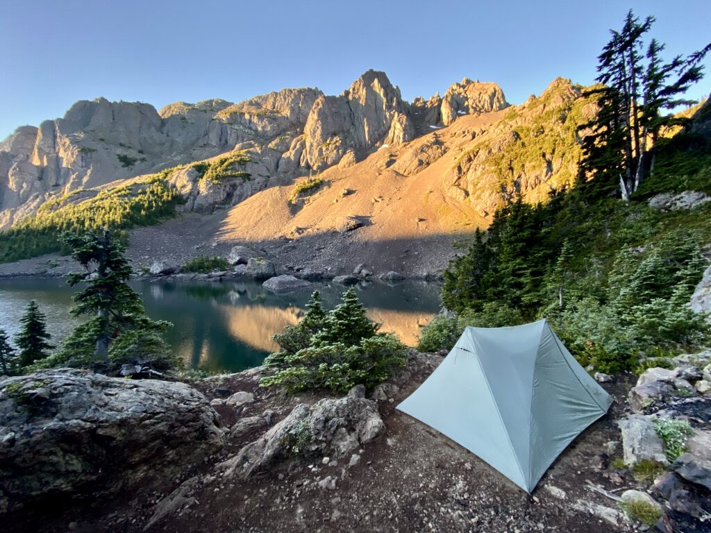
The pass itself features a gorgeous meadow with some nice campsites tucked into groves of trees. I opted to hoof it up to a ridge above the pass. This was a short but steep climb for the end of the day, but the views were spectacular. Unfortunately rain moved in as I was eating dinner, and it rained off and on throughout the night—so my dreams of admiring the stars with my rain fly flung wide open were dashed. I read for a bit and crashed at about 8 pm.
Day 2
4.8 miles | 1,578’ elevation gain
I’d planned this as a short day due to what I expected to be a tough climb over to Charlia Lakes. This was good planning.
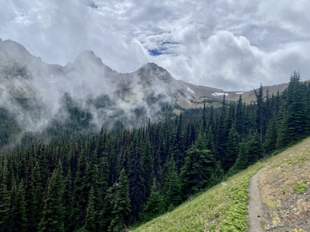
After a mostly overcast and rainy Day 1, rain tapered off around dawn on Day 2 and yielded to some gorgeous, golden light up on the ridge. I took my time packing up and then took the Upper Dungeness Trail down to Boulder Shelter. Like the Tubail Cain Trail, this was very well maintained and a welcome change from the terrain I’m used to in New England and the Adirondacks. That, plus wildflowers, more views, and some welcome shade through the final switchbacks.
I filled up on water at the creek near Boulder Shelter and checked out some of the campsites in the meadow. I can imagine it getting packed on weekends, but I was there during the week and there was just one group set up in the shelter itself. While the views in the meadow of the towering, rocky peaks above are great, the smell here is not. (There are no outhouses or privies at the camps and shelters in the Buckhorn Wilderness according to the ranger I spoke to ahead of my trip. That becomes painfully obvious in some areas.)
From Boulder Shelter, I followed the trail to Home Lake for just a bit before branching off on the Charlia Lakes Way Trail. It gets steep quickly and a series of switchbacks delivers you to a flat stretch that might lull you into believing most of the climbing is over. It’s not.
Eventually you hit a small pond where there are two very nice spots to pitch a tent. From here, you can finally see the top of the pass, and I almost noped out at this point. It’s a 650’ climb in about a half mile, and from the bottom it looks like a doozy. I put my faith in the trail builders and in my own body, and told myself it was OK to turn around at any point. If I didn’t make it over to the lakes, the little pond would be an amazing place to camp, anyway.
This short stretch of trail had a bit of everything: solid single track, a bit of scrambling over some talus, switchbacks with a narrow tread traversing the very steep slopes, and some epic but vertigo-inducing views. At the top you’re greeted by the stunning view of Upper Charlia Lake below, as well as the realization that you need to go down about 600 feet through a scree field. With some careful footwork I got down just fine and followed the sometimes very faint trail to Lower Charlia Lake.
The lower lake is one of the most stunning places I’ve seen, and it feels like you’re at the end of the earth. Deep and an incredible shade of turquoise, the lake sits in a cirque of bare peaks and evergreen slopes.
The campsite has enough space for two tents, maybe three if they’re small. A cold stream flows into the lake nearby, providing an excellent water source.
I set up my tent and then stretched out on a rock perch right at the site, looking forward to a long afternoon of reading and staring at the otherworldly view.
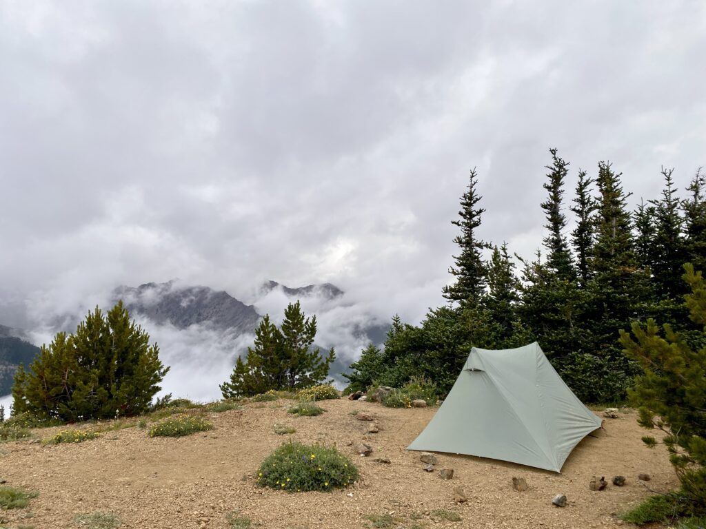
But as they say, mountains make their own weather, and after about an hour I found myself sitting inside a cloud. I mean, so thick that I couldn’t even see the lake just a few yards away. By 7:30 or so I figured it wasn’t going to budge, so I turned in.
Day 3
11.4 miles | 2,262’ elevation gain
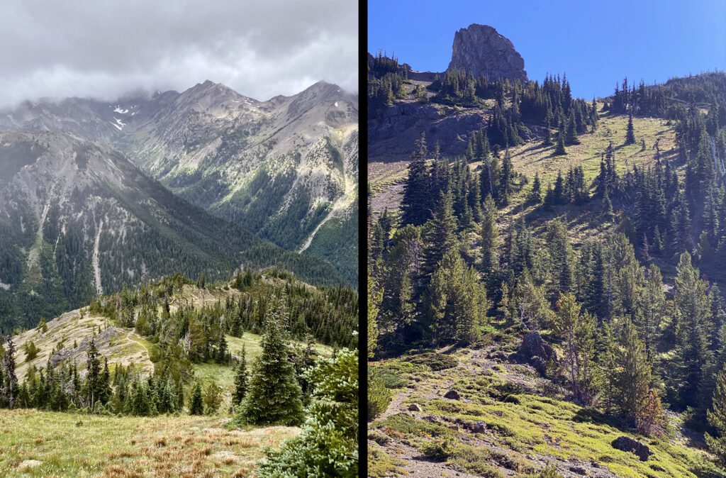
I woke up to sparkling blue skies and the sun setting the tops of the nearby mountains aflame. I sat for a long time and watched the morning light change, insects emerge, and good-sized trout rising all around the lake.
On my mind was the climb out of the basin. The only option was to go back the way I came, and the climb out felt intimidating. I imagined getting hopelessly mired taking one step forward in the scree only to slide back three times as far. In the end it wasn’t bad at all: I made it from the bottom of the slope to the top in about 45 minutes and it felt incredible.
I’d originally planned to spend a third night, possibly camping at Buckhorn Pass. But the climb from Boulder Shelter back up to Marmot Pass was also quick. I felt strong and started thinking about how nice it would be to start my visit to family—my main reason for heading to the Pacific Northwest—a little earlier than expected.
The remaining miles, all downhill after Buckhorn Pass, flew by. Before I knew it I was enjoying a burger and admiring the deepening twilight on a dock at The Brass Kraken Pub in Poulsbo, Washington.
Gear notes
- I picked up a pair of Topo Athletic Terraventure 4 trail running shoes ahead of this trip, testing them out on a few local hikes and a shakedown trip in the Adirondacks. Their wide toebox is perfect for my feet, and I ended each day without the soreness I usually experience with heavier hiking boots.
- The Durston X-Mid 1p is a thoughtfully designed trekking pole tent that has two doors with huge vestibules. It offers a particularly nice refuge if you’re caught in wet weather. Little touches like magnetic door toggles are brilliant. There’s a learning curve if you’re coming from the world of freestanding tents; staking it out at just the right angles is critical for a proper pitch, and it can take some adjusting. I practiced a fair amount at home and found Dan Durston’s video pitching guide extremely helpful. I also downloaded diagrams to my phone that were helpful for fine-tuning in the field.